

Site Inspection | Mapping
More than just a pretty picture.
You've probably heard that a picture is worth a thousand words, but 2D and 3D maps are worth so much more.
These highly detailed maps allow accurate measurements of distance, area, volume, and elevation. Users can also pan, zoom and rotate the view making them useful tools for a variety of applications including: real estate, construction, land development, mining, agriculture, and more.
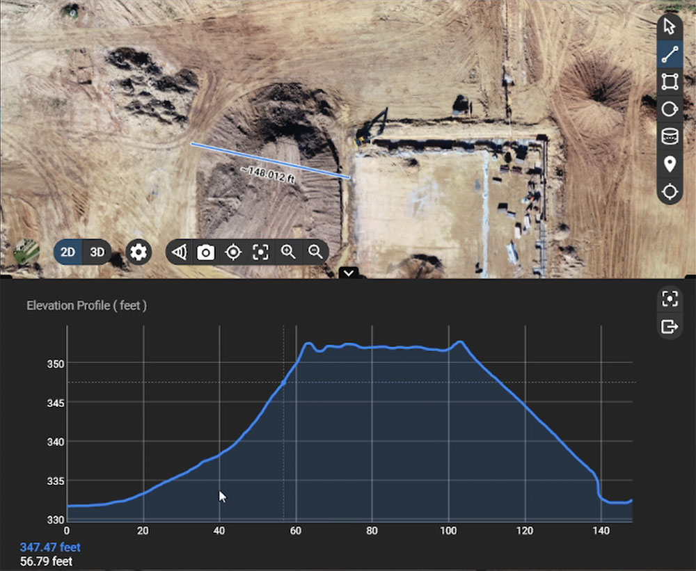
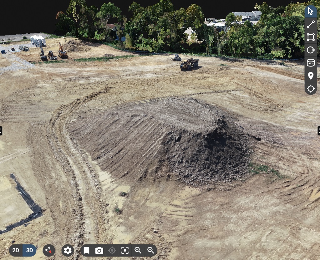
3D Map View provides all of the measuring capabilities of the 2D view but can lend even more accuracy when measuring volumes and vertical features. Viewing the map in 3D view also gives you a clearer understanding of elevation and context of the site.
Any point on a map can be selected to view the source photos that were used in rendering that part of the map and measurements and annotations can be saved.
Easily share your maps, measurements, and annotations with team members, clients, and stakeholder with the click of a button.
More than meets the eye.
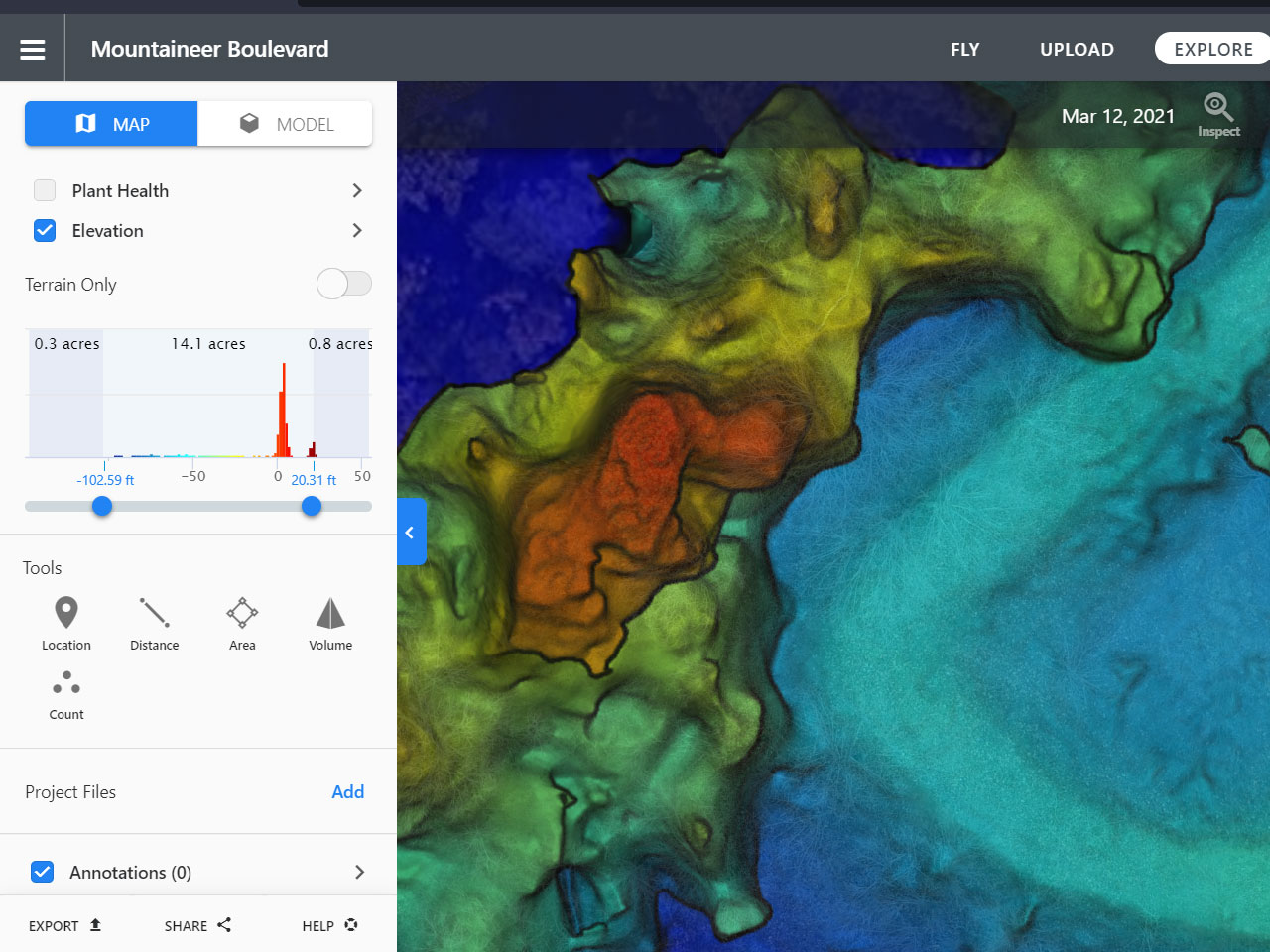
Our drones capture data that can be used to depict information beyond what can be seen with the naked eye.
Two examples are plant health maps, which allow users to gauge plant health and predict crop yields; and elevation maps that use color gradients to show accurate elevation and surface contours.
Contact us today to learn what our site inspection and mapping services can do for you.